We were measuring it wrong

Two reports this week letting us know that we should be measuring something better when it comes to earth system science in the tropics:

– We often aren’t surveying large enough areas to figure out how trees in the Amazon respond to and recover from big disturbances like storms and droughts.  If you do a landscape-level survey using a combo of field work and remote sensing, like these guys did (Chambers et al., 2013), you might find 9-17% more tree mortality than we would otherwise expect.

– We should have also been looking at the Indonesian peatland carbon getting exported in streams (Moore et al., 2013). This study shows that accounting for carbon that’s no longer locked up in peatland soils and is now being lost to the stream system could increase the total GHG emissions post-land use/land cover change from peatlands by more than 20%. Plus, that carbon being lost is crazy “ancient” and implies an inherent instability in the peatland carbon dynamics post-deforestation.  Bad news bears.

And the slow steady march of getting progressively better at answering questions (and at deciding which questions to ask) continues…

2013-02-03 10.31.29

Anta (tapir) sez: science!!!

Make graphs to answer questions: a great example of what ecologists do

So, reeeeaaaalllly big picture, what researchers do: ask questions, and then try to answer them. This week, one puzzle I was trying to solve was a great example of one tiny part of that process.

I’m here in Brazil in large part to measure nitrous oxide emissions, hoping to answer the question: how does land use affect the emissions regime and nitrogen cycle disruption of tropical soil? (Some more info here.)

To answer that question, I’m in charge of figuring out a protocol for how I’m going to measure nitrous oxide (N2O), when I’m going to measure it, how I’m going to process the data, eventually interpreting what the data tells me, and writing up the results. That, and several other projects, and I am hopefully deserving of a doctorate of philosophy (hey-o!).

N2O emissions are influenced by temperature, soil moisture, and the amount of available soil nitrogen, among other factors. When I’m designing an experimental protocol (i.e. when I’m going to sample and how), it’s bad news bears to vary many of those factors at once.

Last week, I turned to Paul and asked him the question, “so, do you think sampling in the morning is legit?” (Researchers: we’re less intense than you would think.) This post is about the quest to answer that question.

What might vary between the morning and afternoon that doesn’t vary day to day? Temperature. OK, how much does temperature vary throughout the day? And does “morning” (ehhhh, so imprecise!) do an ok job of estimating the average daily temperature?

We can answer that!

Check it out! Some data!

thermocouple_exploratory_jpg

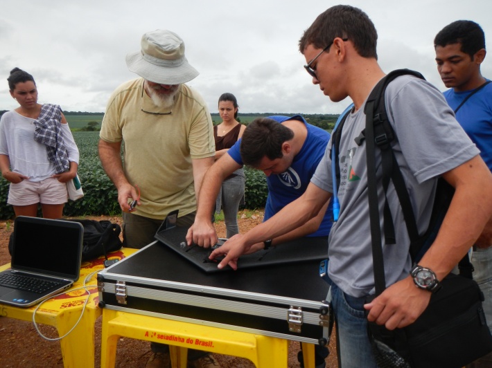
I mentioned last week that Paul and I put a thermocouple out into the forest and soy fields with the goal of taking some daily temperature data.

The graph above is the variation in temp in a soy field and in a shady forest over the course of several days, one of which was wicked rainy and one of which was wicked sunny. Let’s make the assumption that a rainy day and a sunny day can pretty much represents the rainy season here – not totally unreasonable.

I graphed the data (woot!) and calculated the daily mean soil temp in the two land uses (see the text just below the legend on the graph). You can see that the soy soil is, on average, warmer than the forest soil. No surprise there; it’s shady in the forest, and there’s leaf litter on the ground to help moderate temperature. (Side point that’s really cool – the soy soil also has much wider swings than the forest soil.)

Then I calculated the standard deviation of the daily temps in the two land uses, and the grey lines represent all the temps that fall BOTH within one standard deviation around the forest mean soil temp AND one standard deviation around the soybean mean soil temp. Where the graph falls between those lines, we’re within one standard deviation of the average daily soil temp of either soil – meaning we’re in the magical land of “representative daily temperature” for either land use. Meaning we’re good to go if I sample then. Huzzah!

What times of day are between the grey lines? Roughly, the morning hours (more specifically, between around 630 and 1130 am).

So, Paul, “do you think sampling in the morning is legit?” Answer: yes! Proceed, young grasshopper!

Answering that simple question took me a week: learning to use the thermocouple, setting the thermocouple up in the field, waiting a few days, removing the thermocouple from the field, downloading the data, putting the data in a graph and figuring out how to determine if the morning was ok, and, you know, deciding what colors to make the graph (fun!).

But…. problem solved! I won’t inadvertently mess up this project by sampling across a wide temperature gradient!

Science!!!!!!

In conclusion: that’s what I do for a living, and get to put “tropical ecosystem ecologist” on my business card. Sweet deal! :)

The day that we flew a freaking DRONE

The most ridiculously amazing thing happened to me today. I stood next to a regular human being who flew a freaking drone over a portion of Amazon forest and mapped it. It took 20 minutes and it was the MOST. BADASS. THING. EVER!

Here are two pictures of Manuel Ferreira, a professor at Universidade Federal de Goiás (UFG), setting up the drone.

Image

The thing, first off, is commercially available, which is insane. Sure, it costs $25,000, but in terms of scientific equipment that’s a vaguely accessible price. It’s made of some sort of fancy styrofoam and has embedded in it a little slot for a radio (to signal back to “home”, i.e. where you launched it so it knows where to land), a GPS (so it can fly a route that you pre-define using your friendly neighborhood GIS software), a camera (so it can take photos and map the place you want it to map) and two little rudders. Today the flight path we sent the drone on (!) flew over a riparian buffer zone of intact forest that my friend Marcia Macedo has studied.  “Urubu” (“vulture,” as we took to calling it) flew along the route at 300 m altitude (which is crazy high when you’re watching from the ground) and took photos at intervals along the way that were stitched together for one big photo of the forest at a 10 cm resolution. And then the drone flew itself back to us and landed calmly in a patch of soybean field without needing any extra instructions. An entire chunk of forest, photographed at 10 cm resolution, from a styrofoam airplane drone. That is nuts!

Image

Manuel and his two colleagues (also from UFG) are here because they brought a group of 35 undergrads out to the field for a “short course,” a hands-on week long course that brings undergrads into field research environments (“prática integrada de campo II”, or the spring semester’s integrated field practicum). The students were great and I even gave a guest lecture about my nitrogen work in English while Marcia translated. My attempts at teaching in Portuguese were pretty hilarious.

Tomorrow we head back to town for the weekend, during which time I hope to post about my first chunk o’ data (rad!) and my adventures this week wearing lab gloves while scrubbing bat droppings. Research: very, very glamorous!

Getting my ducks in a row

What’s that phrase, a stitch in time saves nine? Field work kind of works that way, too. There’s a lot of time that you sort of feel like isn’t productive enough, but I have to remember to take the long view because if I don’t get your ducks in a row at the beginning it’s wayyyyy more difficult later to try and fix the problem/justify a decision I made. Inevitably I’ll screw a bunch of things up and not have taken care of them before the project started (first rule of field work: accept that for a bunch of the time it’ll be bananas), but the more things that I can guard against the better.

This week was (and next week will be) all about crossing those t’s and dotting those i’s. Luckily, I had a field veteran with me to rock some mentoring and make sure that I didn’t end the week curled up in the fetal position, weeping. This is Paul!

2013-01-22 15.39.47

Paul works as a researcher at WHRC and he is awesome. I adore him already. He’s been helping me put together the gas flux chambers and plan out a bunch of the organizational details that I had punted on until I got down here. (What time of day are we going to sample? How are we going to get everything done in the field with two people as efficiently as possible? What kinds of obstacles have other students run into that I should be thinking about? etc.) Paul is a complete treasure trove of wisdom about this sort of stuff. Plus he’s handy and rad and knows tons of science.

First thing we did was build a bunch of nitrogen gas flux chambers. Rod Venterea at UMN came up with this design for his lab and passed it on to me, but a lot of the assembly I waited to get in country to do since the materials packed up smaller as component parts:

2013-01-22 16.31.18

(More about Rod and his insanely great lab manager Mike Dolan in a future post I’m going to call “people who saved my butt when I was getting ready to leave for Brazil”… or something like that.)

We also had to go out into the forest and come up with a way to get the chamber bases (i.e. the bottom part of the chamber that we attach the top part to in order to capture the gas fluxes) into the ground as easily as possible. Baxi, one of the many amazing field workers at the ranch, carved this cool board to fit the bases perfectly so all I had to was jump on the thing a few times and, boom, I was ready to do science!

DSCN0009

Finally, nitrogen gas fluxes are regulated in large part by temperature and soil water content, plus the amount of nitrogen floating around in the soil that’s available to bacteria. Soil water content we can’t really control, since rain drives it, but what temperature the soil is when sampling we can control – by sampling during the morning (cooler soil) or the afternoon (warmer soil). For this study, I don’t want to look at temperature changes, but I do want to make sure that I’m not sometimes sampling in the morning and sometimes sampling in the afternoon – i.e. I don’t want to introduce a confounding variable into the study. So, I need to have a sense of how much the soil temperature varies over the course of the day so that later I can justify that a sample at 10 am is within roughly the same temperature regime as a sample at 11:30 am.

So we did that! Paul and I (ok, Paul) set up two thermocouples to take the soil temperature every 15 minutes a few inches below the soil surface in a forest plot and in a soybean field. At the same time, I recorded what my analog soil thermometers reported the soil temperature as to make sure that the thermometers didn’t vary from each other and that they were aligned with the thermocouple data.

2013-01-24 07.20.44

Happy to report that there were no lemons out of my eight thermometers!

DSCN0006

We’ll pick up the thermocouple equipment and download the data on Monday (it’s been running since Thursday) and I’ll get to take a look. Very excited to do so! Aside from letting me get some hands on some sweet data (data!!!!!!), I’ll get to head back into the forest. Yessssssssss!

DSCN0002